
We have finished work within the project Dynland-2. The object based version of our Dynland technology for image classification was developed.
We have commenced work within the ESA- financed project SentiMap (Sentinel for confidence in outdated maps). The project is focused on the development of a technology supporting creation of updated topographic maps by detecting change areas in Sentinel satellite imagery or any other up-to-date imagery. The project is implemented with participation of experts from Latvian …
Read more
We have commenced work within the ERDF- financed project ForestRisk (Remote sensing based system for forest risk factor monitoring). The project is focused on the development of software tools for assessment, monitoring and alerting of forest risk factors using satellite and unmanned aerial vehicle (UAV) based remote sensing . The project is implemented in cooperation …
Read more
We have finished work within the project WoodStock. Three different approaches to estimation of forest stock volume by species were developed, two of them implemented as software prototypes.
We have commenced work within the ESA- financed project Dynland-2 (Object based context aware self-learning network for land cover classification). The project is focused on further advancement of our land cover classification technology Dynland by including capabilities to perform object based context aware classification.
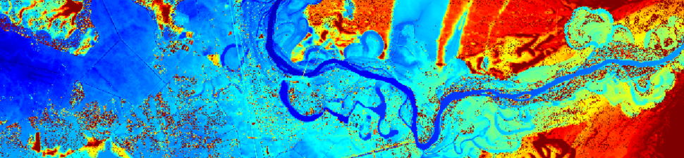
We have commenced work within the ESA- financed project MireClass (Automated identification of mires and peatlands using multi-temporal satellite data). The project is focused on the development of a web application for monitoring and analysis of current state and dynamics of raised bogs and peatland inventory in an easy and convenient way using multispectral and Synthetic …
Read more
Results of the Dynland project was presented by R.Dinuls to ESA representatives at ESA/ESRIN in Frascati, Italy on September 13, 2019. Project deliverables are accepted and the project is successfully finished.
We have commenced work within the ERDF- financed project WoodStock (Satellite remote sensing-based forest stock estimation technology). The project is focused on the development of the prototype technology for estimation of forest stock volume from high-resolution satellite data, including methods for identification of tree species, estimation of tree height, estimation of forest density and estimation …
Read more
Joining the Copernicus Accelerator programme 2018
November 5th, 2018 | Posted by in Uncategorized - (0 Comments)As a finalist of the Copernicus Masters 2018, a seat in the Copernicus Accelerator programme 2018 has become available for us. Thus we will participate in Copernicus Accelerator Bootcamp taking place on 3 – 4 December 2018 in Marseille, France. The Copernicus Accelerator is a project of the European Commission’s DG Growth, and is part …
Read more
From October 16 to 18 we visited the trade fair Intergeo 2018 in Frankfurt, Germany.
Copyright © 2025 All rights reserved.
Designed by 