
GUDPILS
Project No.4 “Development of technologies for secure and reliable smart city”
National Research Programme „Cyber-physical systems, ontologies and biophotonics for safe&smart city and society.” (SOPHIS).
Project No.4 “Development of technologies for secure and reliable smart-city”. Project leader Dr.sc.comp. Ints Mednieks.
The overall objective of the project is to develop a world-class expertise in the area of “smart” city technologies, which can be used for monitoring of environment and urban infrastructure to ensure a safe and reliable living environment for citizens, thus creating the basis for development of competitive services and products.
Within this framework and in accordance with the “Regulation of the competition for National Research Programmes in the period of 2014-2017”, namely tasks 9, 10, and 11 set for the 2.2 Programme “The next generation of information and communication technology systems”, the following specific objectives are put forward:
- Provide centralized urban monitoring for security needs, based on the collection of data from video and other sensors located throughout the urban area, fast data transmission and efficient processing using high performance computing technology for the identification of specific security threats and generate warnings about them;
- Advance the use of satellite or airborne remote sensing (RS) data for the control of emergency situations and dynamic monitoring of environment by transforming the information provided by remote sensors to the form of maps illustrating parameters characterizing an emergency or environment and their changes;
- Develop a mobile ultra-wideband (UWB) antenna array radar-based imaging technology for mapping urban underground infrastructure as well as for creation of advanced security systems working in conditions where the direct visibility is obstructed or impossible, including examining the possibility of wireless data transmission of radar images in the 60GHz range;
- Solving the bacteriological safety problems of city’s water supply by creating a specialized control system.
Involvement of the REMSENS group included:
- Development of the classification algorithm involving fusion of data from different sensors with different spatial resolution
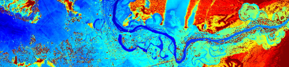
- Development of the ground model from LiDAR data and its application for the simulation of flooding:
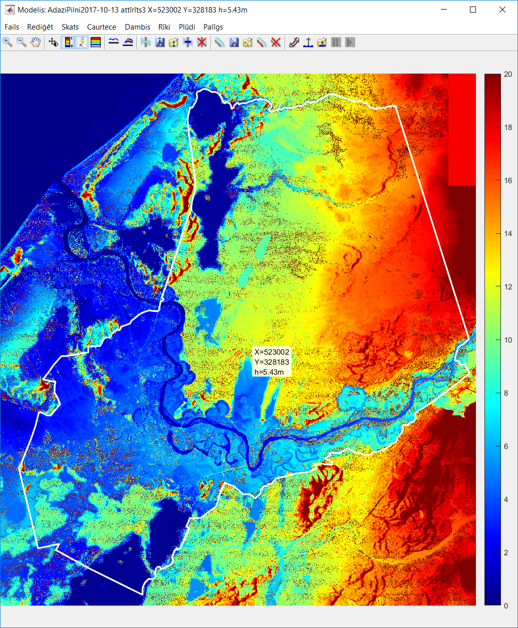
Ground elevation model of Adazi district in developed application program (centre coordinates 57.13°N, 27.41°E)
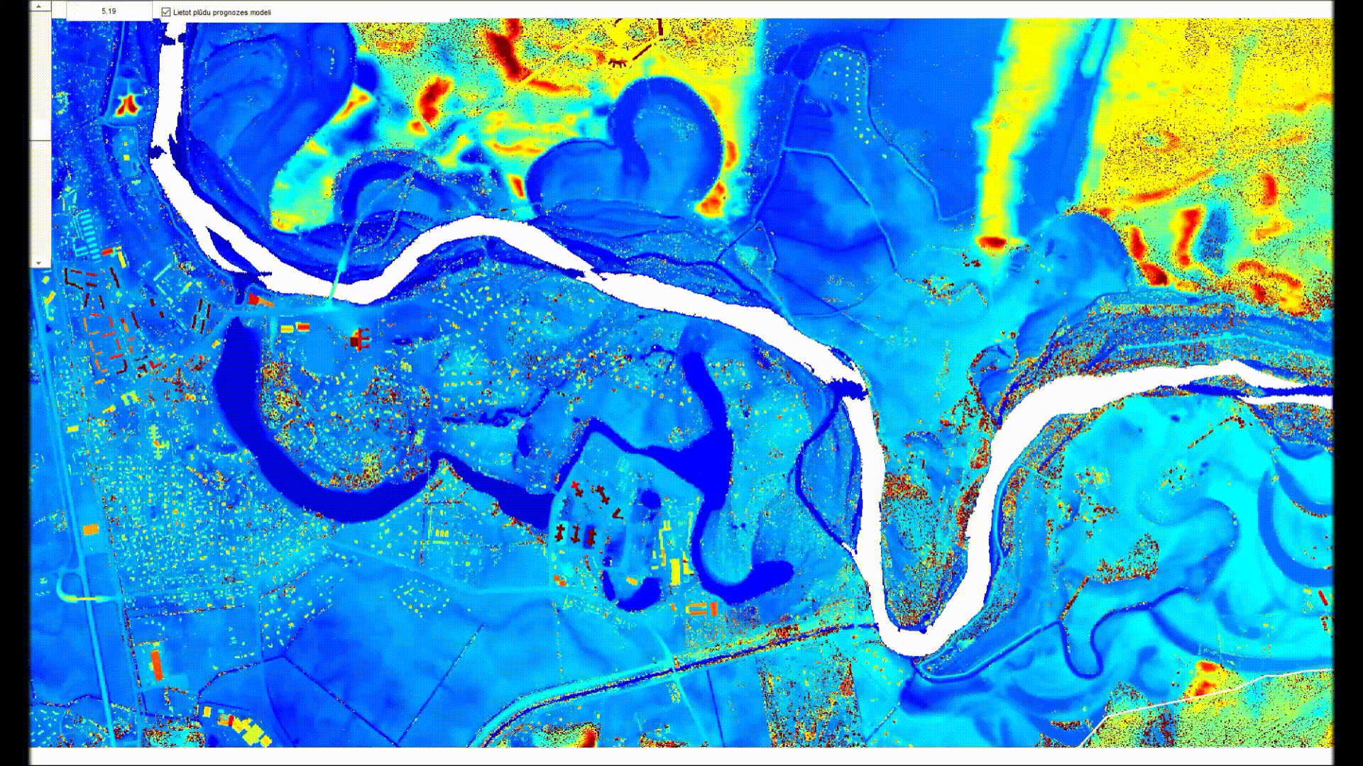
Potential flooding simulation in current circumstances
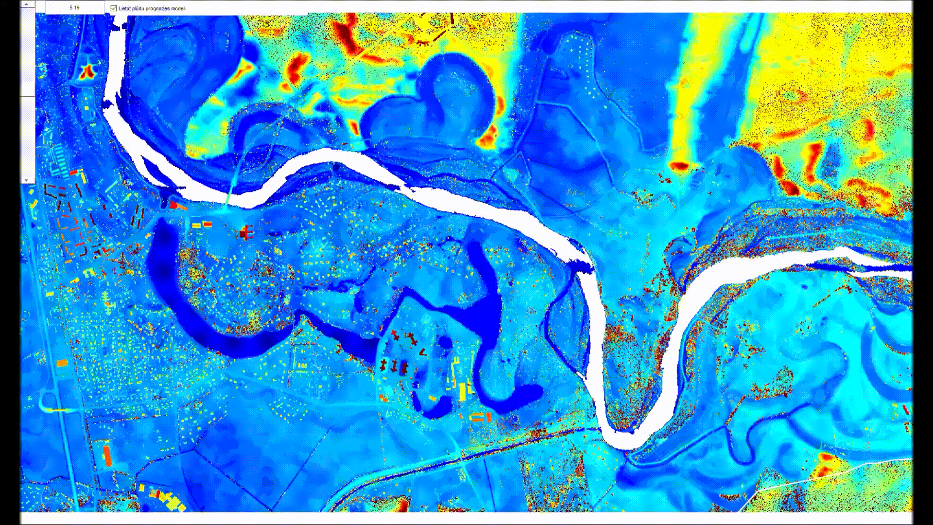
Flooding simulation with introduced virtual dam
- Development of the method for selection of informative spectral bands from the hyperspectral image