Dynland
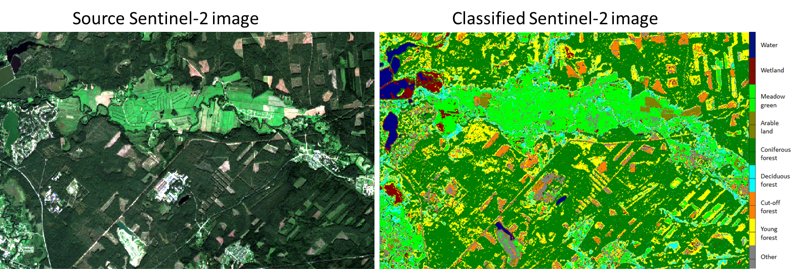
Land cover classification from satellite images is one of the main Earth observation (EO) tasks starting from the launch of first EO satellites. It is used for producing land cover maps showing areas covered by forests, agriculture areas, water basins, roads, buildings and other categories that are needed for the accounting of land resources. We have created an automatic classification technology Dynland which is unsupervised and highly robust. Our working prototype allows users to classify multispectral geospatial images for land cover. Dynland technology enables the use of machine learning methods in applications where it was not possible before due to the lack of sufficient training data. For others, lesser requirements on training data mean significantly lower cost and faster delivery of geospatial analytical results. Our technology provides a highly accurate classification of the objects on the image. It takes a satellite image, clusters all pixels, then assigns classes to clusters and provides users with information about classes and their sizes.
Our clustering algorithm is non-parametric and does not mix clusters due to inappropriate assumptions about their statistical properties as some other popular algorithms (K-means, ISODATA) do. It is generic and apart from multispectral bands can employ other types of information about the scene thus performing data fusion in a straightforward way. Clusters are organised in a multilayer deep network that allows users to regroup and classify clusters according to each need (e.g. join birch and oak forest under the same group – deciduous trees). The second part of technology is an automatic or manual assignment of semantically meaningful classes to clusters (e.g. plant species, pest or disease identification).


